![](https://static.wixstatic.com/media/d4759f_f850df63ba08431790f74f2e41e2c5a3f000.jpg/v1/fill/w_980,h_551,al_c,q_85,usm_0.66_1.00_0.01,enc_avif,quality_auto/d4759f_f850df63ba08431790f74f2e41e2c5a3f000.jpg)
CONSTRUCTION & REAL ESTATE
SERVICE YOU CAN TRUST
CONSTRUCTION
We specialize in photogrammetry, 2D & 3D mapping, volume calculations, annotations, design & map overlays, and weekly construction reports consisting of both video and photo's.
![Construction Site](https://static.wixstatic.com/media/11062b_48330c5d8aa243c78982cd437f18daef~mv2.jpg/v1/fill/w_559,h_373,al_c,q_80,usm_0.66_1.00_0.01,enc_avif,quality_auto/11062b_48330c5d8aa243c78982cd437f18daef~mv2.jpg)
REDUCE COST AND INCREASE PRODUCTIVITY WITH SMARTER CONSTRUCTION PROJECT MANAGEMENT
![Improve_as-built_monitoring_with_aerial_imagery.jpeg](https://static.wixstatic.com/media/d4759f_51dacb0ce8f14e17ad4222e9b78cf16b~mv2.jpeg/v1/fill/w_508,h_286,al_c,q_80,usm_0.66_1.00_0.01,enc_avif,quality_auto/Improve_as-built_monitoring_with_aerial_imagery.jpeg)
Timeline Analysis
Visual timeline of your jobsite for site tracking and project documentation
Compare Progress over time
Compare two specific days to spot what has changed
Compare & Calculate Volumes
Precise volume calculations and compare them over time.
Virtual Inspections
Remotely inspect any jobsite from any device or location, just with an internet connection
Overlay Maps and Design Plans
Compare the as-built with the as-designed instantly to verify site progress
Measure, Annotate and Share
Measure distances, highlight critical elements and share data with your team, clients or stakeholders
![33298bee2bcc37438dce7d1b47281078476a5364_mackbook_sidebyside_med.png.webp](https://static.wixstatic.com/media/d4759f_427fe930dd6a46ca93eec4c98a9c144b~mv2.png/v1/fill/w_483,h_275,al_c,q_85,usm_0.66_1.00_0.01,enc_avif,quality_auto/33298bee2bcc37438dce7d1b47281078476a5364_mackbook_sidebyside_med_png.png)
REDUCE COST AND TIME
Better track and manage the construction progress. Get regular aerial visual updates of the as-built situation in 2D and 3D to compare site against the as-design. Visualize, measure, track onsite changes and export data acquired at all stages of a project for more efficient project execution. Identify errors early, keep control on schedule and prevent costly rework.
​
-
Topographic survey
-
Visual records of excavation
-
Stockpile measurement
-
Cut and fill calculation
-
Accurate haul cost estimate
-
Civil engineering work
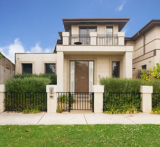
![DJI_0350.JPG](https://static.wixstatic.com/media/d4759f_ca5586fcfa3b466086dcca2c06a1e7f4~mv2.jpg/v1/fill/w_588,h_331,al_c,q_80,usm_0.66_1.00_0.01,enc_avif,quality_auto/d4759f_ca5586fcfa3b466086dcca2c06a1e7f4~mv2.jpg)
REAL ESTATE
The real estate market never sleeps, and for you to ensure your property stands out above the rest, Aerolens ensures state of the art, high quality pictures, and videos of your site, including walkthrough videos, and aerial videos.
![Modern Kitchen](https://static.wixstatic.com/media/b0edc92d78514a2c886152b3ec845969.jpg/v1/fill/w_559,h_394,al_c,q_80,usm_0.66_1.00_0.01,enc_avif,quality_auto/b0edc92d78514a2c886152b3ec845969.jpg)
![Villa](https://static.wixstatic.com/media/000e73d2ee214ec38b9d2056da9f4623.jpg/v1/fill/w_324,h_299,al_c,q_80,usm_0.66_1.00_0.01,enc_avif,quality_auto/000e73d2ee214ec38b9d2056da9f4623.jpg)
Photography
Covering all your needs for interior and exterior photography of your property
![Camera Gimbal](https://static.wixstatic.com/media/11062b_a2d9f3c0d9d147d2ac68189fd33d4b93~mv2.jpeg/v1/fill/w_328,h_219,al_c,q_80,usm_0.66_1.00_0.01,enc_avif,quality_auto/11062b_a2d9f3c0d9d147d2ac68189fd33d4b93~mv2.jpeg)
Videography
Truly demonstrating the interior and exterior of your property in 4K video
![DJI_0985.jpg](https://static.wixstatic.com/media/d4759f_a88e9ca78b3a4fb68a921ccef2640141~mv2.jpg/v1/fill/w_328,h_185,al_c,q_80,usm_0.66_1.00_0.01,enc_avif,quality_auto/d4759f_a88e9ca78b3a4fb68a921ccef2640141~mv2.jpg)
Aerial Cinematography
Gain a birds eye view of your property in both photo and video format